Overview

The Carlsbad Watershed Management Area (WMA) is comprised of six (6) distinct hydrologic areas covering a land area of 211 square miles. The WMA extends from the headwaters above Lake Wohlford in the east to the Pacific Ocean in the west, and borders San Luis Rey and San Dieguito Watersheds to the north and south, respectively.
There are numerous important surface hydrologic features within the Carlsbad WMA including four unique coastal lagoons, three major creeks, and two large water storage reservoirs. Unlike many of its neighboring WMAs, the Carlsbad WMA is also unique in that it is primarily comprised of independent and fully functional watersheds.
These include the following hydrologic areas:
- Loma Alta (904.1)
- Buena Vista Creek (904.2)
- Agua Hedionda (904.3)
- Canyon de las Encinas (904.4)
- San Marcos (904.5)
- Escondido Creek (904.6)
Currently, about thirty-two percent (32%) of the WMA remains undeveloped. The other major land uses making up the remaining sixty-eight percent (68%) of the land area are residential lands (29%), agricultural lands (12%), freeways and roads (12%), commercial and industrial lands (6%), and miscellaneous uses (9%). To see a more definitive breakdown of land uses by hydrologic area, please refer to the descriptions below.
One of the most densely populated portions of San Diego County, the Carlsbad WMA is estimated to be home to approximately 620,235 residents, based on 2020 U.S. Census data. Given its concentrated population, the watershed suffers from several pollutants, that have the potential to negatively impact how residents, business-owners, and tourists use and interact with local water bodies.
The WMA serves more than just humans, however. In fact, the Carlsbad WMA consists of a variety of unique and diverse ecosystems that act as critical habitat for a number of endangered species, including the California gnatcatcher, least bell’s vireo, and the orange-throated whiptail.
For more information about water bodies see the San Diego Basin Plan, which provides information on uses of water bodies and water quality objectives, beneficial uses and the 303(d) list, which identifies water body segments not meeting water quality standards.
Water Quality Improvement Plan (WQIP)
Agencies involved in the development of the Carlsbad Water Quality Improvement Plan (WQIP) include the County of San Diego and the cities of Carlsbad, Encinitas, Escondido, Oceanside, San Marcos, Solana Beach, and Vista. The WQIP is a requirement of stormwater regulations adopted by the Regional Water Quality Control Board (Regional Board) according to Order No. R9-2013-0001, as amended by Order Nos. R9 2015-0001 and R9-2015-0100. The goal of the WQIP is to protect, preserve, enhance, and restore water quality of receiving water bodies. These improvements in water quality will be accomplished through an adaptive planning and management process that identifies the highest priority water quality conditions within the watershed and implements strategies to address them.
The Carlsbad Water Quality Improvement Plan was originally submitted to the Regional Board in June 2015 and after revisions based on Regional board comments, an acceptance letter from the Regional Board was issued on November 22, 2016.
2021 Update
The 2021 update of the WQIP was initiated to comply with a November 2019 RWQCB comment letter. The update incorporates an assessment of bacteria data for Agua Hedionda Lagoon and revisions noted in prior Annual Reports. As part of the update, a request for public data was released, the consultation panel was reconvened, a public meeting was held, and there was a 30-day public comment period. The 2021 WQIP was submitted to the Regional Board in January 2021. The Responsible Agencies received a comment letter from the Regional Board in May 2021 and revised the WQIP to address comments. The revised WQIP was submitted in September 2021 and accepted by the Regional Board in December 2021.
2018 Update
In 2018, the WQIP was updated to include the Escondido Creek Hydromodification Plan and minor revisions noted in prior Annual Reports. The update process included reconvening the consultation panel, a public meeting, and a 30-day public comment period. The update was completed and accepted by the RWQCB in May 2018.
Previous versions of the WQIP, appendices and the acceptance letter can be found in the document archive.
WQIP Annual Reports
The Carlsbad Watershed Management Area (WMA) Water Quality Improvement Plan (WQIP) Annual Reports allow copermittees to demonstrate progress made during the fiscal year towards achieving water quality goals. They are a direct requirement of the National Pollutant Discharge Elimination System (NPDES) Permit, Order No. R9-2013-0001, as amended by Order Nos. R9-2015-0001 and R9-2015-0100. The Annual Reports contain specific information regarding strategy implementation and monitoring efforts and data. Furthermore, they serve as a basis upon which copermittees may choose to adaptively manage their highest priorities and goals/strategies, according to the most recent water quality data.
Below are the most recent annual reports, to view years prior click here.
Monitoring data for the Carlsbad Watershed can be accessed through the California Environmental Data Exchange Network (CEDEN) http://www.ceden.org/ or the WQIP Annual Reports.
Jurisdictional Runoff Management Plans
The Regional Stormwater Permit (Order No. R9-2013-0001, as amended by Order Nos. R9-2015-0001 and R9-2015-0100) requires that the San Diego Region Copermittees provide access to their Jurisdictional Runoff Management Program documents on a Regional Clearinghouse website. The purpose of JRMP documents are to guide implementation of programs and strategies to reduce pollutants discharged from each Copermittee’s storm drain system to receiving waters. The JRMPs for each Copermittee involved in the Carlsbad WMA are linked to below.
City of Carlsbad JRMP and GIS data files
City of Encinitas JRMP and GIS data files
City of Escondido JRMP and GIS data files
City of Oceanside JRMP and GIS data files
City of San Marcos JRMP and GIS data files
City of Solana Beach JRMP and GIS data files
City of Vista JRMP and GIS data files
County of San Diego JRMP and GIS data files
BMP Design Manuals
The Regional Stormwater Permit (Order No. R9-2013-0001, as amended by Order Nos. R9-2015-0001 and R9-2015-0100) requires that the San Diego Region Copermittees provide access to their BMP Design Manuals and associated documents on a Regional Clearinghouse website.
The BMP Design Manuals for each Copermittee involved in the Carlsbad WMA are linked to below:
City of Carlsbad
City of Encinitas
City of Escondido
City of Oceanside
City of San Marcos
City of Solana Beach
City of Vista
County of San Diego
Model BMP Design Manual
The San Diego County Copermittees developed a Model BMP Design Manual for the San Diego Region in order to conform to updated development requirements of the 2013 Municipal Storm Water Permit (Order No. R9-2013-0001, as amended by Order Nos. R9-2015-0001 and R0-2015-0100). The Model BMP Design Manual provides procedures for planning, selecting and designing onsite structural BMPs for new development and significant redevelopment projects in accordance with the 2013 Municipal Permit. Additionally, the Regional Manual provides a basis for the development of local BMP Design Manuals by each Stormwater Copermittee in the San Diego region.
Each Copermittee was required to update its local BMP Design Manual in accordance with the content of the regional model on or before the February 16, 2016 deadline outlined in the 2013 Permit.
The final model BMP Design Manual, its appendices, and associated materials can be retrieved here:
Other Plans and Projects
Additional plans and projects not necessarily associated with the Water Quality Improvement Plan (WQIP) are listed below.
Transitional Monitoring and Assessment Program Report (TMAR)
A requirement of the Municipal Permit Order No. 2013-0001 (as amended in Order Nos. R9-2015-0001 and R9-2015-0100), transitional monitoring was conducted and reported on prior to development of the Carlsbad WQIP. The reports, appendices, and associated documents can be found below:
Things To Consider
When excessive quantities of pollutants are deposited into these water bodies, they may inhibit many or all of the above beneficial uses and can result in actions such as beach closures and postings, etc. Agricultural and urban runoff, sewage spills, and livestock have been identified as primary contributing sources.
Under Section 303(d) of the Clean Water Act, multiple water bodies were listed as impaired for several different pollutants, as indicated in the 303(d) table above. These conditions are required to be addressed through a number of best management practices and regular monitoring. As such, copermittees (also referred to as Responsible Agencies (RAs)) under the region’s National Pollutant Discharge Elimination System (NPDES) Permit focus their treatment and cleanup efforts on these particular water quality conditions.
As part of the process, however, copermittees are required to develop a comprehensive Water Quality Improvement Plan (WQIP) for the WMA that identifies highest priority water quality conditions, strategies to address them, and monitoring plans. The WQIP and associated Annual Reports are required by Order No. R9-2013-0001 as amended by Order Nos. R9-2015-0001 and R9-2015-0100 and pertain specifically to improving the quality of both storm water and non-storm water discharged by copermittees’ municipal separate storm sewer systems (MS4s). A revised WQIP for the Carlsbad WMA was submitted to the Regional Water Quality Control Board for approval in June 2016.
Hydrologic Area (HA) Descriptions
Loma Alta HA (904.1)
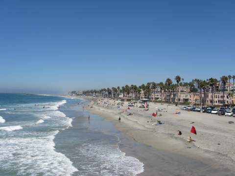
Oceanside Beach – http://www.san-diego-beaches-and-adventures.com/images/Oceanside-Beach-View-North-of-Pier.jpg
The Loma Alta Hydrologic Area is situated at the northern end of the watershed management area (WMA). At just over 6,300 acres, the hydrologic area comprises only five percent (5%) of the Carlsbad WMA. The system is contained almost entirely within the City of Oceanside, but also lies partially within the jurisdictions of the City of Vista and the County of San Diego.
The majority of surface runoff here is directed into Loma Alta Creek and subsequently drains through Loma Alta Slough into the Pacific Ocean. A 107 acre wetland, the Slough is influenced by intermittent tidal forces and is known to provide valuable habitat to a variety of native plant and animal species.
The area is relatively urbanized, with open space and undeveloped land comprising just twenty-one percent (21%) of the land area. Significant portions of the Loma Alta Creek have been subject to human modifications; namely, the construction of concrete-lined channels. These alterations, among others, have contributed to the degradation and fragmentation of riparian habitat corridors and a reduction in the value of critical ecosystem services previously offered by the natural channel and wetlands.
Buena Vista Creek HA (904.2)
Buena Vista Lagoon
The Buena Vista Creek Hydrologic Area encompasses a land area of roughly 14,400 acres and stretches inland approximately 10.6 miles. Located just south of the Loma Alta Hydrologic Area, it is divided among several different jurisdictions, including the City of Vista, the City of Oceanside, the City of Carlsbad, and the County of San Diego.
Many of the Carlsbad WMA hydrologic areas contain a number of common features and are quite comparable in layout; most notable is a primary creek or stream that deposits surface water into the Pacific Ocean by way of an estuary or lagoon. The Buena Vista Creek Hydrologic Area is no exception in this regard. The creek ends at Buena Vista Lagoon, where it eventually discharges into the ocean. Home to notable wildlife and many species of birds, the freshwater lagoon is separated from the ocean by a man-made weir. The lagoon also serves as a collecting point for fishermen and for local bird watchers.
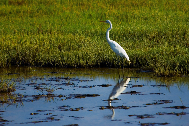
The Buena Vista Creek Hydrologic Area’s open areas and ecological reserves provide refuge to wide arrays of native plants and animals, including a number of endangered and threatened species. In total, Buena Vista Creek and Buena Vista Lagoon Ecological Reserves sum to over 223 acres and are home to such flora as widgeon grass, pondweed, and arrow grass. They also provide valued habitat to terns, ducks, grebes, raccoons, and opossums, among countless other species.
Over eighty-seven percent (87%) of the watershed has been developed. The majority of that development is related to residential land uses, which comprise about fifty percent (50%) of the watershed land area. This is then followed by lands dedicated to transportation, commercially zoned land, and miscellaneous land uses.
Due in part to human activities associated with extensive development, Buena Vista Creek Lagoon was listed as impaired under Section 303(d) of the Clean Water Act for heightened bacterial levels and excessive concentrations of nutrients, sediments, and silt. Anthropogenic changes associated with construction, daily activities, and channelization of streams and creeks are also assumed to contribute to these water quality conditions.
Agua Hedionda HA (904.3)
Agua Hedionda Lagoon – http://lagoon.aguahedionda.org/images/crane.jpg
The Agua Hedionda Hydrologic Area is approximately 18,800 acres in size and makes up roughly fourteen percent (14%) of the Carlsbad WMA. Copermittees responsible for the Agua Hedionda Hydrologic Area include the Cities of Carlsbad, Vista, Oceanside, and San Marcos, as well as the County of San Diego.
The southwestern slopes of the San Marcos Mountains mark the beginnings of Agua Hedionda Creek, which subsequently flows a distance of just over 10 miles before discharging into the Pacific Ocean at Agua Hedionda Lagoon. The lagoon supports a number of beneficial uses including recreational activities and wetland habitat.
Between Carlsbad Highlands and Agua Hedionda Lagoon, the hydrologic area contains over 650 acres of Ecological Reserve land. Species supported by this land include California gnatcatchers, turkey vultures, and golden eagles. The diversity of habitats, ranging from coastal sage scrub to salt marsh and mudflat habitats, also supports a number of mammals, amphibians, and reptiles.
Over seventy percent (70%) of the system is developed (29% is open space or undeveloped), residential land uses lying at the forefront at thirty-three percent (33%). With continued development, habitat fragmentation and channel hydromodification have also accelerated.
Unfortunately, the Agua Hedionda Creek Hydrologic Area is not without impairments. The Creek itself has been listed as impaired under Section 303(d) of the Clean Water Act for heightened bacteria levels, toxicity, and elevated concentrations of manganese, phosphorus, selenium, nitrogen, and dissolved solids. The Agua Hedionda Lagoon, which had previously been listed as impaired, has seen significant improvements in overall water quality over the last few years that inevitably warranted removal from the 303(d) list of impaired water bodies.
Canyon de las Encinas HA (904.4)

The smallest hydrologic area within the Carlsbad WMA, the Encinas system is only about 3,400 acres in size and is located entirely within the jurisdiction of the City of Carlsbad. A relatively minor creek, Encinas Creek, is the primary water body within the hydrologic area and flows directly into the Pacific Ocean. Industrial land uses constitute a significant portion of the land area here, which has ultimately resulted in the channelization of many of the smaller tributaries and creeks.
San Marcos HA (904.5)
Batiquitos Lagoon – http://visitcarlsbad.com/uploads/cache/Image/GalleryItem/id/1734/75f0a9e5f5aac44d6cc697e5d290480b1224c9ff.jpg
At about 36,000 acres in area and comprising roughly twenty-eight percent (28%) of the WMA, the San Marcos Hydrologic Area is the second largest of the Carlsbad systems. One of its distinguishing features is that the Upper and Lower San Marcos Hydrologic Areas areas have been made largely independent of one another by the Lake San Marcos impoundment. As such an expansive system, monitoring of the San Marcos Hydrologic Area storm water conveyance system falls on the County of San Diego and the Cities of San Marcos, Escondido, Carlsbad, Vista, and Encinitas.
San Marcos Creek and Encinitas Creek are the two major tributaries in the hydrologic area, converging prior to discharging into the Pacific Ocean at Batiquitos Lagoon. Batiquitos Lagoon is located in the City of Carlsbad and encompasses 540 acres of wetland habitat, including least tern nesting sites. Without significant impairments of any beneficial uses, the lagoon serves as a prime example for many other water bodies in the region.
Approximately seventy-two percent (72%) of the watershed is developed (28% is open space or undeveloped), the leading land use being residential at thirty-three percent (33%). The Upper San Marcos Creek area supports agricultural (primarily in the County of San Diego), urbanized and open space land uses. Lower San Marcos, on the other hand, has a significant amount of open space and urbanized areas.
Similar to other portions of the Carlsbad WMA, channelization of sections of the tributaries to upper San Marcos Creek was utilized as a strategy to protect properties from flood damage. This channelization has had several negative impacts on the surrounding environment, including degradation and fragmentation of riparian habitat corridors and a reduction in the value of critical ecosystem services previously offered by the natural channel and wetlands. Furthermore, San Marcos Lake was identified under Section 303(d) of the Clean Water Act as impaired due to high concentrations of nitrogen and nutrients.
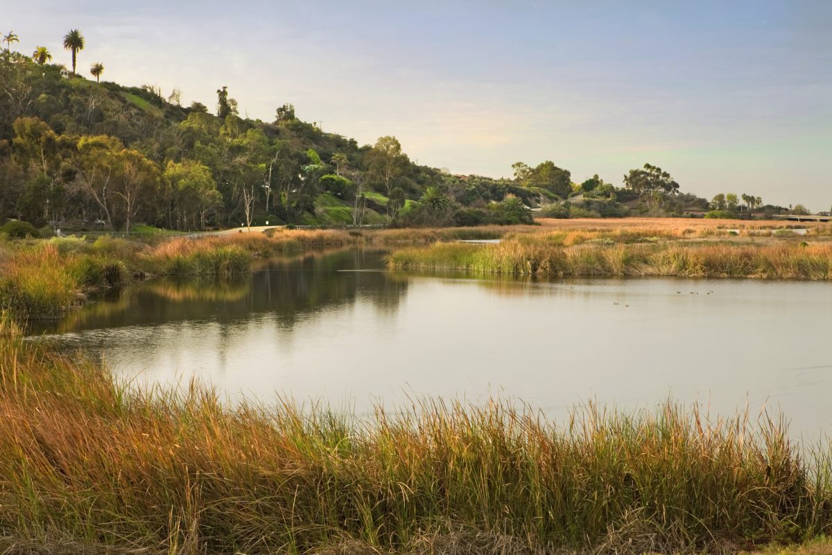
Escondido Creek HA (904.6)
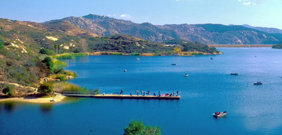
Dixon Lake – http://sdfish.com/lakes/dixon-lake/#prettyPhoto/0/
As the most expansive and complex system in the Carlsbad WMA, the Escondido Creek Hydrologic Area covers a land area of roughly 54,100 acres and constitutes forty percent (40%) of the entire WMA. Extending approximately twenty-five (25) miles inland, it is also the southernmost hydrologic area in the WMA and borders San Dieguito Watershed to the South. The Escondido Creek Hydrologic Area is dominated primarily by unincorporated areas of the County of San Diego. The remaining land area is divided up between the Cities of Carlsbad, Escondido, Encinitas, San Marcos, and Solana Beach.
The hydrologic area contains the largest share of open space and undeveloped lands of any of its counterparts, only sixty percent (60%) being developed. As the second most common land use type, residential areas comprise thirty-four percent (34%) of the system.
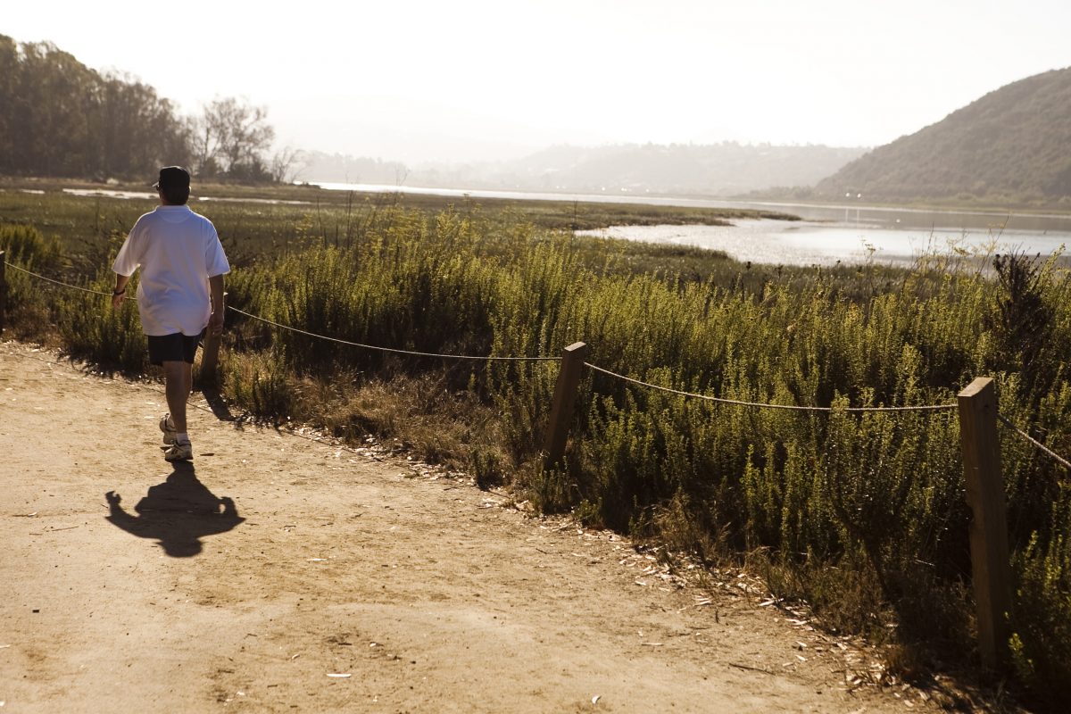
The Escondido Creek Hydrologic Area meets the Pacific Ocean at San Elijo Lagoon, a wetland habitat of 576 acres. Prior to discharging into San Elijo Lagoon, however, the creek originates in Bear Valley in north central San Diego County, nearby Daley Ranch, a 3,000 acre conservation area managed by the City of Escondido. The watershed is also home to two reservoirs: Lake Wohlford and Dixon Lake. As a flood control measure, parts of Escondido Creek, specifically the portion draining through the City of Escondido, have been subject to concrete-lining and channelization.
The Escondido Creek system consists of a number of water bodies that are listed as impaired under Section 303(d) of the Clean Water Act. The San Elijo Lagoon is impacted primarily by indicator bacteria, eutrophic conditions, and sedimentation/siltation. Escondido Creek is listed for DDT, Enterococcus, Fecal Coliform, Manganese, Phosphate, Selenium, Sulfates, Dissolved Solids, Nitrogen, and Toxicity.